mistercanoehead header & home page link

BARRON CANYON 2011
(Algonquin Provincial Park)


We have avoided Algonquin Park for a couple of decades, since it always appeared to be crowded in the months of July and August. Due to a shorter than usual time frame, it seemed to be the best option. Drive time from Guelph plus on the water time was going to be about 5 days (Sept. 12 - 16).
As well, we had heard that the Barron Canyon Route was a good one to take in September.
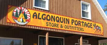
Our intention was to put in at the Achray campground and pull out at Squirrel Rapids. Our vehicle would be shuttled to Squirrel to meet us by Algonquin Portage (located on the Barron Canyon Road).


Monday, Sept. 12 - We arrived at Achray mid afternoon after a 6 1/2 hour drive. As we put in, it began to drizzle a bit.
Grand Lake is a big one, but it was calm for our crossing. The clouds indicated more rain in the offing, so we set up camp just before the turn into Stratton Lake. A mixture of sun & cloud with a bit of rain lasted until supper time.

The campsites along the spit at the end of Grand Lake were great - flat, clean with easy access. The night was warm and muggy.

Tuesday, Sept. 13 - When we got up at 7:00 am, the wind had picked up and by 8:00 am, we had a a rather intense rain storm. We sat it out, broke camp, and paddled around the corner into Stratton Lake. A dam necessitated a 30m portage.

Stratton Lake was very nice with quite a few campsites along the north shore. We saved ourselves a 45m portage between Stratton and St. Andrews Lakes by lining the creek. The 550m portage into High Falls Lake was fairly easy.


A bit past the portage was a railway bridge
which was part of the old CN line.


At the end of the portage was a neat falls that had an almost mystical feel about it.


Parts of a deer skeleton were scattered over the logs at the base of the falls.


The "shower" was quite refreshing.The 550m portage was a bit steep at the High Falls Lake end.


Wednesday, Sept. 14
- After spending the night on High Falls Lake, we were up early to walk the trail to High Falls. Maples had already started to change colour.


As we wended our way along the trail, there were some very nice views of the "drop & pool" aspects of the waterway between St. Andrews and High Falls Lakes.


Years of glaciation and water erosion has smoothed out the rock to the point that you can slide down this section.


There are several of these pools along the way. I have a feeling that this area gets a lot of use during the warmer weather. The trail from High Falls Lake was fairly easy to navigate and has been keep quite clean.


The Ooze Lake portage was shorter than 300m with a bit of "up & down". We waited until a group ahead of us had cleared the pull-out, then portaged into Opalescent Lake. We had read that there was a campsite with an elaborate seating arrangement and fire pit on this lake. We investigated and found what shows in the photo. Someone had a lot of time and energy on their hands!!


The clouds rolled in mid afternoon, so we got off the water and set up camp on Opalescent for the night. The rain started at about 6:00 pm.

Thursday, Sept. 15 - We awoke to a crystal clear, cool morning with some wind. Tried fishing with no results.


The portages to Brigham Lake and around Brigham Chute (730m, 100m, 440m) were fairly easy and, according to our GPS, actually shorter than the map distances.


We shared the 440m portage with a couple of groups who were "day trippers" going to have a look at the canyon. The canyon showed some evidence of lava type flow in the rock. Probably metamorphic reheating.


There are hiking trails along parts of the canyon top for those who prefer shoes to canoes.


The canyon starts out low, then rises to a height of 100m.
The current is slow enough that you can easily go back upstream for another look at the walls.
According to what we have read, the canyon was one of the main outflow conduits for the upper Great Lakes during the last ice age. One can only imagine the current and whitewater conditions at that time!
3.2km downstream is Cache Rapids. This is a major chute/falls! Portage this one all the way (river left 420m).

The last stretch of the river to the Squirrel Rapids take-out is quite placid. Our vehicle had been left here for us, so we packed up and returned to Achray, where the Park Warden let us camp overnight at one of the "Jump-off" sites. The night temperature had dropped to 2oC, necessitating the use of down jackets.


Friday, Sept. 16 - Struck camp, had breakfast in Petawawa, and got back to Guelph by 4:00 pm.
This trip is a good one for those who are looking for a 3-4 day experience and live within a day's drive from the put-in/take-out.